Washington University's entanglements with slavery and its legacies run deep. The story surrounds us, embedded in the built environment on and around campus.
Follow this link on your mobile device to go on a self-guided walking tour exploring WashU's ties to enslavement and its lasting impacts. Please note that the tour map is designed to be used on a mobile phone for a person physically following the tour. While you may view the tour from your computer, some features will not be optimized for this viewing format.
This walking tour of the Danforth Campus and its environs has 7 stops and takes approximately 45 minutes when followed as a round trip starting and ending at Olin Library.
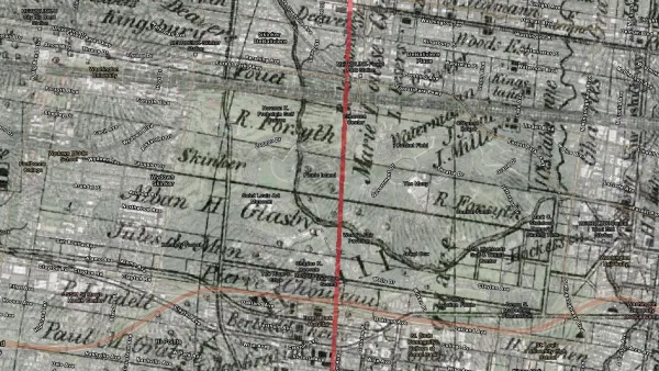
Header image: St. Louis 1857 overlaying today, focusing on the areas of WashU and Forest Park (Sources: WashU & Slavery Project; Gustavus Waagner, New Topographical Map of Saint Louis County, Missouri. Schaerff & Bro., Saint Louis, 1857; Thumbnail image: St. Louis in 1864 overlaying today, focusing on the areas of WashU and Forest Park (Sources: WashU & Slavery Project; J. H. Fisher, Map of the City of St. Louis and Vicinity, City of Carondelet. J. H. Fisher, St. Louis, 1864.